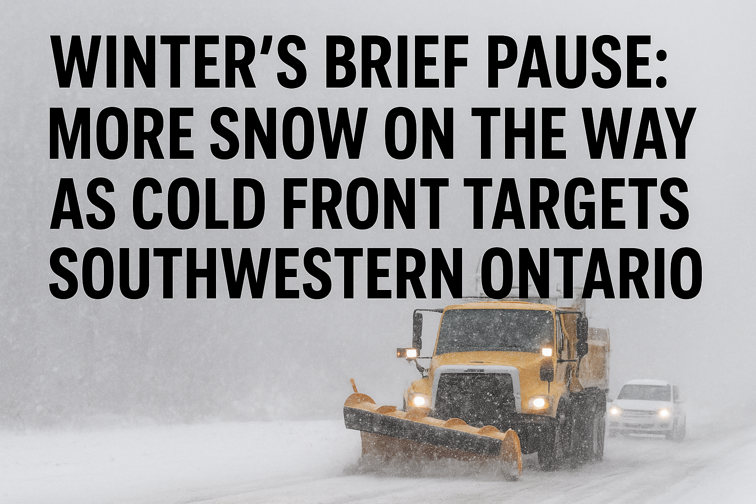
Introduction: A Sudden Winter Blast Stuns Residents
A powerful burst of snowsqualls swept across Huron and Middlesex counties on Thursday, transforming familiar roads into treacherous whiteouts and leaving residents scrambling to keep up with the relentless accumulation. What began as a typical December morning quickly escalated into one of the season’s most intense snow events, driven by persistent streamers off Lake Huron that deposited staggering amounts of snow in just a few hours.
Locals, though seasoned in winter survival, were struck by the speed and severity of the snowfall — a reminder that early winter can still deliver surprises capable of halting daily routines and challenging even the most experienced drivers.
Heavy Streamers Off Lake Huron Bring Rapid Snow Accumulation
Clinton at the Centre of the Storm
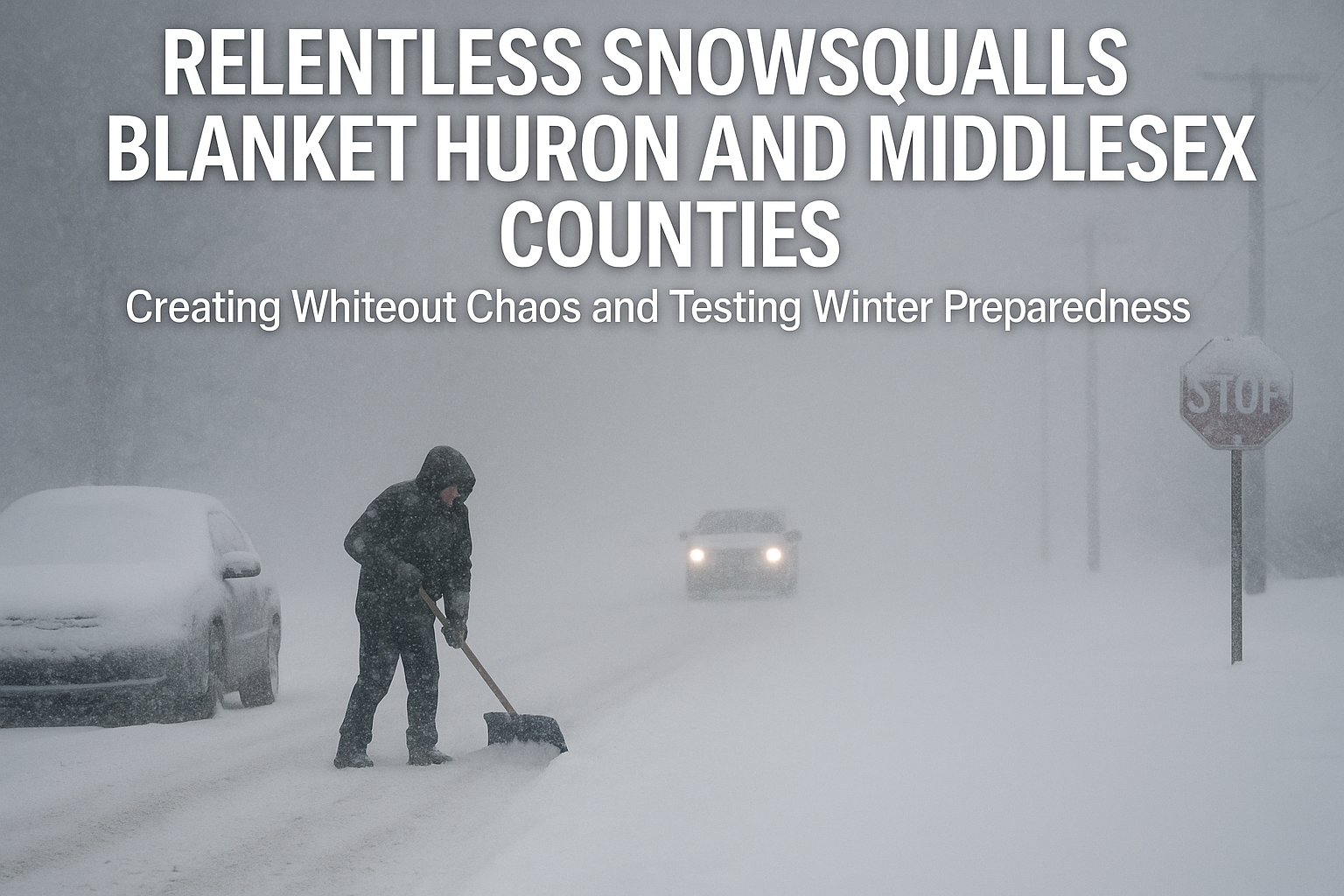
While several communities across both counties experienced difficult conditions, the town of Clinton endured the brunt of Thursday’s weather system. Lake-effect streamers aligned perfectly to deliver continuous, narrow bands of snow directly over the region for hours.
Residents woke to driveways buried under deep drifts, streets vanishing under blowing snow, and visibility conditions that changed minute by minute. For many, the morning became a never-ending cycle of clearing snow only to watch it pile up again.
Homeowners Battle Nonstop Snowfall
Clinton resident Sydney Wettlaufer was among the many who found themselves locked in a losing battle with the storm. Starting her day before dawn, she cleared her driveway only to discover five hours later that nearly all her work had been undone.
“It is unbelievable. I was out here at 6 a.m. clearing the lane, and here I am again just a few hours later doing it all over. Absolutely unbelievable that this is happening,” she said, shaking her head at the sheer volume of snow.
Just a short distance away, Matthew Austin was also shovelling for the second time before noon. Despite the exhausting work, he tried to keep a positive attitude.
“Am I tired yet? Not really — maybe if you come back in a couple of hours I might be,” he said with a laugh. “Right now, so far, so good.”
A Winter Surge That Shows No Signs of Slowing Down
More Than 40 Centimetres Fall in Hours
Environment conditions aligned perfectly overnight and into the early afternoon, allowing Lake Huron to fuel an unbroken stream of snowfall. Some areas saw up to 40 centimetres between Wednesday night and Thursday afternoon alone — a significant amount, even by midwestern Ontario standards.
Over 100 Centimetres in Just Two Weeks
What compounded the challenge was the snow already on the ground. In the past two weeks, much of midwestern Ontario has accumulated more than 100 centimetres, setting the stage for narrowing roads, shrinking shoulders, and towering snowbanks that now obstruct visibility at intersections.
Residents, highway crews, and first responders alike are preparing for what could become a particularly demanding winter season if current patterns continue.
“This is quite a winter so far. The accumulation is just crazy,” Wettlaufer reflected. “It’s coming so fast we can barely keep ahead of it.”
Travel Warnings Issued as Whiteout Conditions Grip the Region
Near-Zero Visibility on County Roads
Police throughout Huron and Middlesex counties reported several areas where visibility dropped to nearly zero. What made Thursday especially dangerous was the unpredictable nature of snowsqualls. One moment, drivers could experience bright skies and calm snowfall; the next, they plunged into blinding whiteouts where pavement markings and nearby vehicles vanished instantly.
Police Urge Drivers to Slow Down and Prepare
Law enforcement agencies repeatedly emphasized the importance of adjusting driving habits to match the sudden weather changes. Officers urged motorists to reduce speed, increase following distances, and approach rural concessions with extreme caution.
“It can go from a sunny, beautiful snowscape one second to a whiteout blizzard with no lines on the road the next,” police said in warnings issued throughout the morning.
In addition, they encouraged residents to equip their vehicles with essential winter safety gear, including snow tires, ice scrapers, emergency blankets, flashlights, and roadside emergency kits — tools that can make a life-saving difference when stranded in hazardous conditions.
Communities Lean on Resilience and Positivity Amid the Storm
A Season Arriving Earlier and Stronger Than Expected
For many residents, Thursday’s weather felt like an early preview of what could be a long and grueling winter season. The intensity of snowfall surprised locals who expected a gradual start to winter rather than a full-scale snowstorm before mid-December.
Still, despite the frustration of repeated shovelling and the challenges of travel, some found themselves embracing the season’s upside.
Matthew Austin noted that, while the snow was unexpected, the early arrival might bring a festive perk:
“It came a little early and was a little unexpected, but I’m assuming now it’s going to be a white Christmas,” he said.
His sentiment echoed the outlook of many who, even while contending with drifting snow and dropped temperature, held onto the excitement that a snowy holiday season brings.
Looking Ahead: Preparing for What Could Be a Demanding Winter
Municipal Crews Working Around the Clock
Snowplows, salters, and maintenance crews across the region worked tirelessly through the morning and afternoon to keep priority routes open. Officials acknowledged that when snowfall accumulates as rapidly as it did Thursday, even well-coordinated operations face limitations.
Rural roadways, open fields, and areas exposed to crosswinds remained challenging, with blowing snow repeatedly covering cleared lanes.
Experts Warn of Continued Weather Instability
Meteorologists noted that early-season cold air passing over warm lake waters is a classic recipe for snowsqualls — and conditions this week fit the pattern almost perfectly. With temperatures expected to stay low and Lake Huron still relatively warm, residents may see similar streamer activity in the coming days.
Preparation, officials say, remains the most reliable defence.
Residents Advised to Stay Alert and Stay Prepared
Whether commuting to work, running errands, or navigating back roads, motorists across Huron and Middlesex counties are being encouraged to monitor weather alerts and plan travel around major snow events whenever possible.
Emergency officials advise residents to:
-
Keep fuel tanks at least half full
-
Store blankets and warm clothing in vehicles
-
Carry chargers, flashlights, and non-perishable snacks
-
Ensure snow-clearing equipment is in good working order
Conclusion: A Community Weathering Winter’s Early Fury
Thursday’s snowsqualls left a powerful impression on Huron and Middlesex counties, demonstrating just how quickly winter can shift from picturesque to perilous. With more than 40 centimetres falling in a matter of hours — on top of the 100 centimetres already accumulated this month — communities are bracing for what could be an exceptionally snowy season.
Yet amid the challenges, residents continue to show resilience, adaptability, and even moments of optimism. Whether it’s battling snowdrifts before sunrise or finding a silver lining in the promise of a white Christmas, people across the region are meeting winter’s early fury head-on.
As snow continues to fall and forecasts hint at further instability, one thing is clear: preparation, patience, and community spirit will be essential in navigating the demanding weeks ahead.